

Concepts Of Soil And Soil Survey NEW

Availability:
In stock
Hard Bond
ISBN: 9788197382086
Publishing Year: 2025
Paper Back
ISBN: 9788197382062
Publishing Year: 2025
Out of stock
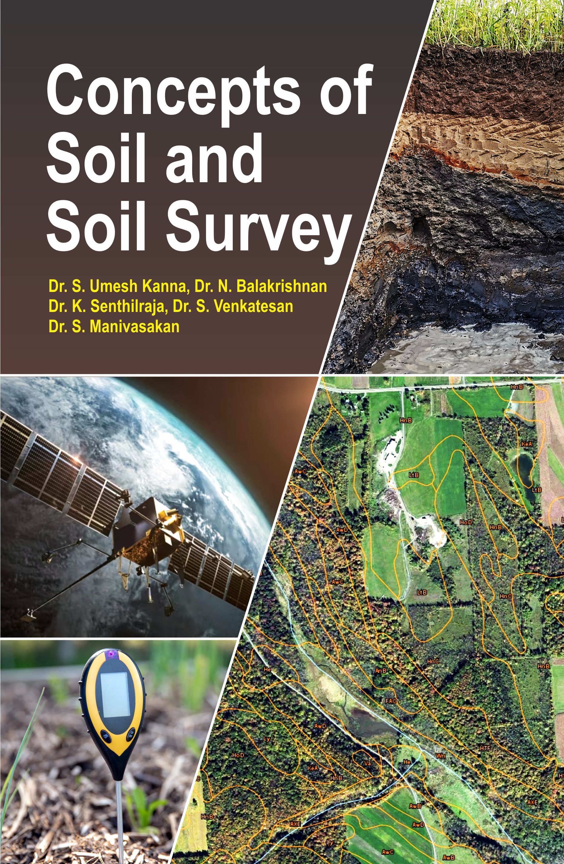
We commence our journey with an insightful analysis of soil surveys in India, shedding light on the methodologies and frameworks employed within this specific regional context. This chapter provides the foundation for understanding how soil surveys are tailored to address the unique climatological and geographical challenges present.
Moving on from region-specific surveys, we delve into the broader concepts of landscapes and geomorphology, emphasizing how they shape and define site descriptions crucial for any soil study. Detailed examination and description of soil profiles form the basis of our understanding, offering a look into the varying layers of soil and their unique characteristics.
The section on soil mapping is pivotal as it transitions from traditional methods to the cutting-edge approaches of digital soil mapping. Here, readers are guided through the principles, stages, and applications of digital mapping, showcasing how technology enhances our capacity to analyze and interpret soils with increased precision.
Geophysical methods and tools for proximal soil sensing are discussed in subsequent chapters, providing insights into the technological advancements that allow for accurate soil data collection. These discussions flow seamlessly into the management and dissemination of soil survey data—a critical aspect of ensuring these insights can be applied effectively across various domains.
Our exploration is further enriched by historical perspectives, notably in chapters discussing the history of soil data management in the U.S., offering an understanding of how past practices inform present and future methodologies. The interpretations of soil properties and their profound impact on land use are meticulously examined, giving readers a lens through which the significance of soil attributes in agricultural and environmental decision-making can be perceived.
In the latter part of the book, specialized themes such as subaqueous soil surveys and human-altered soils are introduced, broadening the scope of traditional soil study. The inclusion of official soil series descriptions and the web soil survey provides practical insights and resources for ongoing exploration and research.
Through this collection of chapters, we aim to equip practitioners, students, and enthusiasts with a comprehensive understanding of soil surveys and soil science. Our hope is to inspire informed decision-making and innovation in land use policies globally. It is with great anticipation that we present this work, inviting readers to delve into the fascinating world of soils with us.
Dr. (Prof.) Kanna US
 555
555 - Introduction to Soil and Soil Survey
- Understanding Soil Surveys in India
- Landscapes, Geomorphology, and Site Description
- Examination and Description of Soil Profiles
- Soil Mapping: An Overview
- Soil Maps Made by Other Methods
- Digital Soil Mapping: Principles and Concepts
- Digital Soil Mapping: Stages and Processes
- Applications of Digital Soil Mapping
- Tools for Proximal Soil Sensing
- Common Geophysical Methods for Soil Sensing
- Soil Survey Data Collection, Management, and Dissemination
- History of Soil Data Management in the U.S.
- Interpretations: The Impact of Soil Properties on Land Use
- Map Units and Soil Interpretations
- Interpretive Soil Properties: Understanding Soil Impact on Land Use
- Understanding Dynamic Soil Properties and their Interpretations
- Aerial Application of Soil Interpretations
- Assessing Dynamic Soil Properties and Soil Change
- Subaqueous Soil Survey
- Human-Altered and Human-Transported Soils
- Official Soil Series Description
- Detailed Map Unit Description
- Web Soil Survey
Book Details
Concepts Of Soil And Soil Survey NEW
TEXT-CUM-REFERENCES BOOK
246
0
0
AMERICAN ROYAL (6X9)
250 Gms
All Rights Reserved
M/s Scientific Research
FIELD WORKERS | PG STUDENTS | SCIENTISTS AND RESEARCHERS |
Books with Same Authors

Books with Similar Subjects


